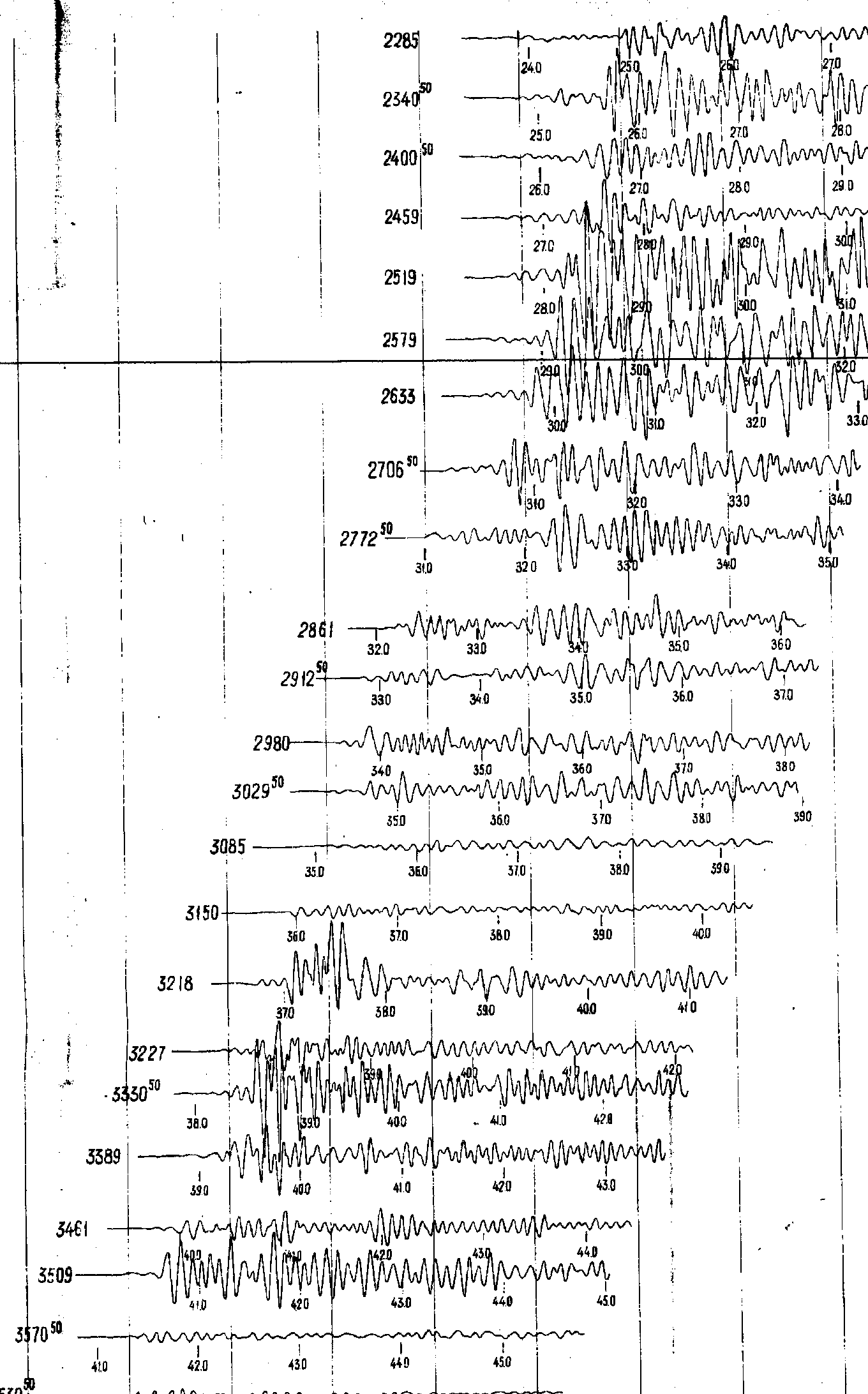
In the sixties, many original photographic-records were processed
this way: some traces were selected (in order to construct a final film-section
with well distributed data) and digitized by hand. The filtering
criteria were function of several parameters, such as total profile length,
station spacing, data quality, etc.. For instance, the example below belongs
to the DSS-profile Volgograd-Nakhicevan, shot-point N-2 to the South. Shot-point
position on the profile is 1030 (in pickets; 1 picket=100 m). Each trace
contains geophone-position (not offset!) and absolute time from the time
break. To determine the offset it's necessary to calculate the difference
between geophone and shot-point positions. Here: the 1st trace has an offset
of 228.5-103.0=125.5 km; reduction velocity is 6.0 km/s, so the reduced
time is 24.0-125.5/6.0=3.08s. It means that the first arrivals of Pg waves
is about 3.0s, PmP phase at about +4.0s. Amplitudes are not normalized,
we can consider only relative aplitudes. The photographic multichannel
seismograms were obtained using band-pass filter centred at about 10 Hz.
one trace every 60 were drawn (that means a spacing station-plot
every 6 km on average), and properly positioned in time. Parameters:
reduction velocity: 6.0 km/s; main vertical lines distance: 1 sec.; amplitude:
not scaled; numerical labels: BIG: geophone position axis [hm: from 2285=228.5
km up to 365.0 about, that is 136.5 km length], small: time-reference [secx10].